|
Virtually every environmental and social challenge being faced globally can be characterized by digital geospatial data. Artificial intelligence (AI) is increasingly embedded into the workflows for managing and processing those data, but much more is possible. By enabling machines to interpret and process the spatial relationships captured by data sets, especially as they exist in the physical 3D world, spatial AI adds tremendous capacity to make breakthroughs.
This year, nine teams completed I-GUIDE’s second Spatial AI Challenge, leveraging the I-GUIDE Platform to develop innovative, responsible, and reproducible solutions guided by FAIR data and open science principles. The winning teams...
|
|
|
|
In mid-July, I-GUIDE will be hosting its annual, week-long immersive Summer School session in which participants integrate spatial AI into problem-solving workflows. This year's six projects will consider challenges of computer vision, model biases, and novel data combinations in urban and rural areas, wetlands and fire-prone regions. The 30 participants were selected from a field of over 150 applicants, a record setting number, and soon the I-GUIDE sorting hat will place the students in their teams. While there is inevitably a hint of friendly competition between the groups, the overall collaborative nature of collective action for worthwhile results is what wins out. Meanwhile, I-GUIDE's Cyberinfrastructure group is already preparing for heavy usage of the Platform and its enabling access to computing resources for this remarkable week. Convergence Team Science in action! July 13-17, 2026, at the University of Illinois Urbana-Champaign.
|
|
|
Plans are well underway for I-GUIDE's 2026 Forum, being coordinated this year with the Harnessing the Data Revolution (HDR) Ecosystem Conference. This joint conference brings together multidisciplinary researchers to shape the future of AI and data-intensive sciences. NSF's Chaitan Baru and the University of Chicago's Luc Anselin will both offer keynote addresses. Dozens of high-quality abstracts were submitted for workshops & tutorials, research presentations, and posters, and an enticing agenda will be announced in June. Registration is now open! Join us August 3-7 in Chicago, Illinois!
|
|
|
|
|
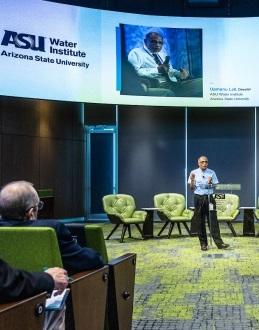
Upmanu Lall, Director of the Water Institute at Arizona State University and a member of I-GUIDE's Convergence Science Catalysts team, was a key convenor of the recent Transforming Water, West event. Participants focused on solutions that will come from the novel ways that technologies, financial investments, and policy responses must be combined. Lall has been central to I-GUIDE's work with Aging Dams.
|
|
|
|
|
Krasen Samardzhiev from Lampata Ltd., a UK-based member of the Open Geospatial Consortium (OGC), participated in the I-GUIDE-sponsored OGC pilot Open Science Demonstrators 2025 (OSPD2025) project. He presented the pilot and the Urban Taxonomy project results during a recent I-GUIDE VCO session. The presentation used the Urban Taxonomy project and the Open Science Persistent Demonstrator (OSPD) to highlight current challenges and opportunities in making scientific data and code truly FAIR and open. It addressed issues in accessing, interpreting, and visualizing urban data, as well as executing reproducible workflows. The talk also demonstrated how OGC OPSD tools and open-source community contributions can enhance open science practices.
|
|
Stay Informed with the I-GUIDE Insider
An easy way to stay in touch with the NSF I-GUIDE Project
|
|
|
The I-GUIDE Insider is a weekly digest of upcoming events and opportunities from the I-GUIDE project as well as recent publications and news. Sign up for the Insider to stay up to date with the I-GUIDE project!
|
|
|
Our I-GUIDE Ascender this quarter is Jinzhe Wang who is a doctoral student in the Department of Geography, Environment, and Society at the University of Minnesota. She is an I-GUIDE Climber and works with the Education and Workforce Development team, focusing on how AI can contribute to the Convergence Curriculum for Geospatial Data Science. Read our full profile of Jinzhe Wang here!
|
|
|
I-GUIDE VCO
Wednesday, June 3 · 11:00 am CT · Virtual
Presenter
Qiusheng Wu · University of Tennessee
Join this session to learn about the open-source, cloud-enabled teaching modules that support end-to-end GeoAI workflows for spatial analysis. The modules leverage Python-based tools such as SamGeo and GeoAI to guide learners through key stages of the GeoAI pipeline, including cloud-based data access, model development, and image segmentation using deep learning techniques. These are now available on the I-GUIDE Platform as part of Dr. Wu's current activities as a UCGIS Community Champion.
|
|
I-GUIDE VCO
Wednesday, June 10 · 11:00 am CT · Virtual
Presenter
Yi Qi · University of Southern California
New to the I-GUIDE Platform, these training modules make it easier than ever to map urban tree cover, a characteristic that is key in climate resilience. This study presents an open, reproducible, and transferable framework that leverages publicly available USDA NAIP imagery. These cover the full workflow, including training data preparation, model development using open-source image segmentation methods, comparison with pre-trained models, and model retraining for knowledge transfer. These are part of Dr. Qi's current activities as a UCGIS Community Champion.
|
I-GUIDE VCO
Wednesday, July 15 · 11:00 am CT · Virtual
Presenters
Yao-Yi Chiang · University of Minnesota
Yijun Lin · University of Minnesota
Zekun Li · University of Minnesota
RegionLM is a geospatial representation learning pipeline for generating contextual region embeddings from heterogeneous OpenStreetMap (OSM) features, including points, lines, and polygons. Built on SpaBERT-style spatial language modeling, RegionLM extracts features within target regions, converts nearby spatial context into pseudo-sentences containing feature semantics and geographic relationships, and learns contextual embeddings that jointly encode semantic, spatial, and topological information. The framework rasterizes line and polygon features into shared spatial grids, aggregates feature-level embeddings into region-level representations, and clusters regions into contextual categories that capture neighborhood structure and urban function. RegionLM supports end-to-end urban representation learning for downstream applications such as mobility modeling and trajectory anomaly detection. This is part of Dr. Chiang's current activities as a UCGIS Community Champion.
|
|
|
Recent research and publications
from the NSF I-GUIDE Project Team
|
|
|
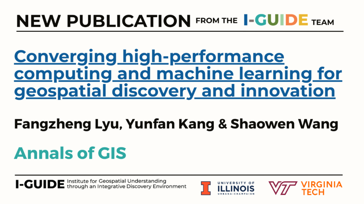
High-performance computing (HPC) and machine learning have together been critical for addressing complex geospatial problems and enabling geospatial knowledge discovery. In a review of 289 studies (1996–2024) on combining high-performance computing (HPC) and machine learning for geospatial research, the authors found that since 2015, integration of supercomputing, cloud, and parallel computing with ML has grown significantly across domains. Key applications include improving speed, accuracy, resolution, and enabling real-time analysis. A future agenda is suggested that covers five research questions and four thrusts: scalable data fabrics, geospatial foundation models, domain-ML integration, and responsible geospatial AI.
|
|
|
|
|