|
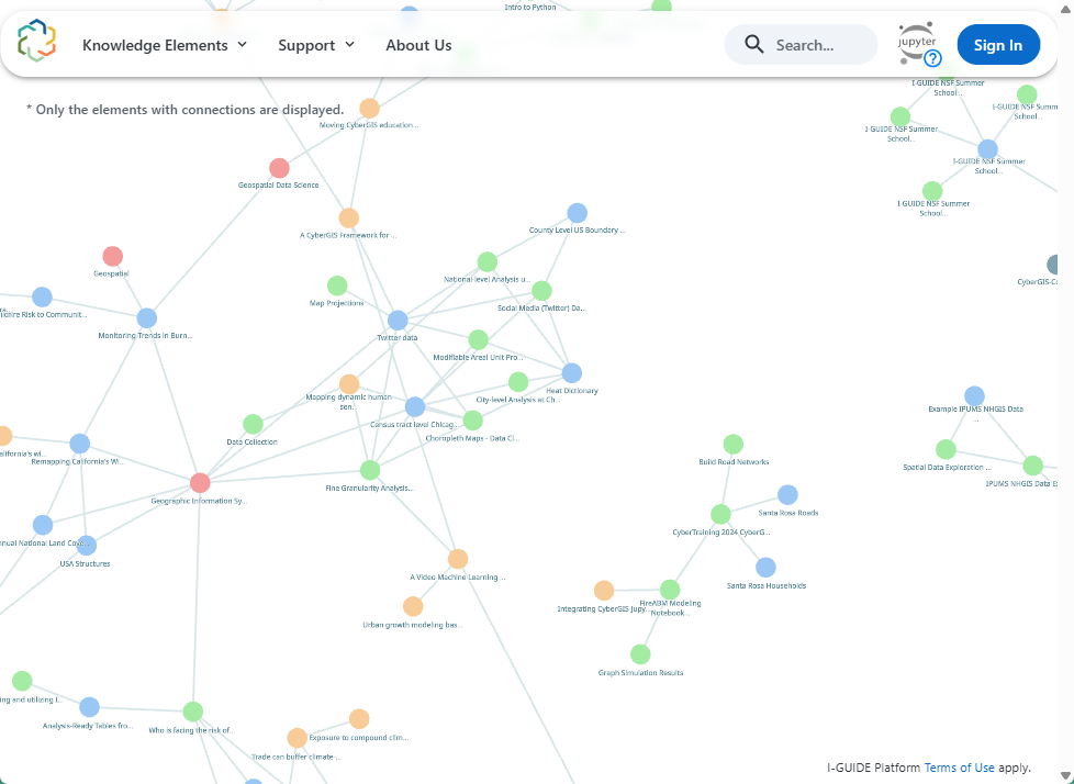
The I-GUIDE Platform provides a collaborative environment for geospatial data-intensive sciences, focusing on convergence research and education. Sustainability and resilience challenges have been the emphasis to date but the Platform is able to support activities on any application areas that require and would benefit from cutting-edge geospatial AI and data science capabilities. That is the niche that the I-GUIDE Platform fills: a digital space
|
|
|
Symposium on Spatial AI and Data Science: Frontiers and Applications
At the upcoming annual conference of the American Association of Geographers in San Francisco, CA (AAG, March 17-21, 2026), I-GUIDE will again be hosting a rich collection of paper & panel sessions and workshops that address the cutting-edge advances of cyberGIS, spatial AI and data science, and data-intensive geospatial understanding derived from spatial and spatiotemporal data synthesis. The I-GUIDE Platform and its JupyterHub will be the focus of a workshop (Friday March 20, 10am – 2pm) to provide hands-on exploration time. If you’re in San Francisco at the AAG that morning, it will be an excellent professional development learning opportunity. Join us!
|
|
|
|
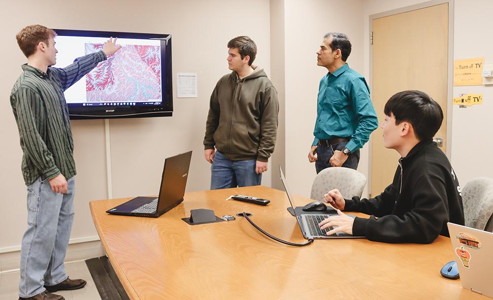
Multiple Steps, Multiple Models, and Computing Power Combine to Support Studies of Aging Dams
The latest work of students at Purdue University, led by I-GUIDE Researcher Venkatesh Merwade, focuses on the scalable modeling approaches that complex aging dam scenarios require. Learn more here.
|
|
|
|
|
Do you have expertise at the intersections of AI, interdisciplinary science, computing, and problems that are rich in geospatial data? Become one of our TEAM LEADERS at the 2026 Summer School! I-GUIDE will be hosting its annual week-long Summer School at the University of Illinois Urbana-Champaign from July 13-18, 2026. The theme this year, Spatial AI and Convergence Science, will allow us to focus on novel applications of models, environmental hazards and disasters, and social and environmental problems that benefit from convergence science and AI approaches. Currently we are recruiting TEAM LEADERS whose research falls within these guidelines to direct small groups of graduate students through to their own novel solutions. Propose your own project! Apply now to be a Team Leader! The deadline to apply is March 2, 2026.
|
|
|
Call for Participation: Papers, Panels, Posters, and Workshops!
At the I-GUIDE Forums, the intersection of AI and science, from geospatial discovery and innovation to the frontiers of convergence science, is the focus for scholars, students, and professionals engaged in this high-need, high-impact area. The 2026 Forum is coordinated with the Harnessing the Data Revolution (HDR) Ecosystem Conference, and this joint conference brings together multidisciplinary researchers to shape the future of AI and data-intensive sciences. The Forum’s Call for Participation dovetails with a Call for Position Papers for the HDR Ecosystem Conference, and the deadline to submit abstracts is in April 2026. All details available via the links above.
|
|
|
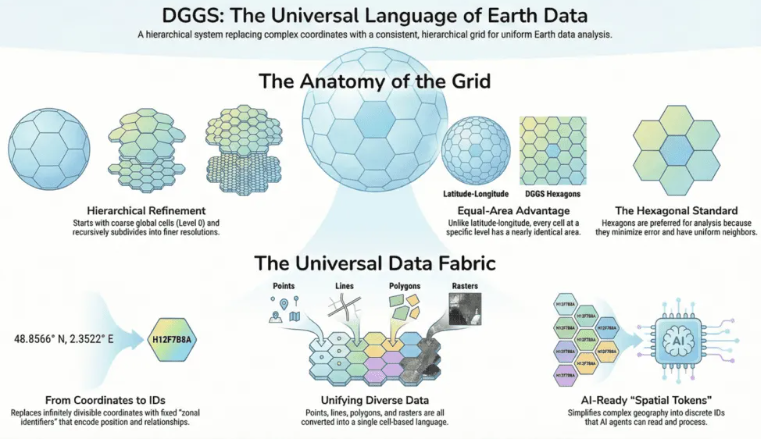
The Open Geospatial Consortium (OGC) has a pilot project underway, focusing on disaster management, that uses DGGS (Discrete Global Grid Systems) as a a common spatial language to consistently reference and analyze heterogeneous disaster data. DGGSs represent the Earth as a hierarchical grid of (mostly) equal-area cells, so diverse geospatial datasets can align, aggregate, and be queried uniformly across scales as every location has a consistent cell ID. These cells mean that geospatial AI can truly be stable, hierarchical, and machine-readable. Want to know more? Join us on Tuesday February 25, 2026 for a VCO on this topic, presented by OGC and TerraFrame.
|
|
Stay Informed with the I-GUIDE Insider
An easy way to stay in touch with the NSF I-GUIDE Project
|
|
|
The I-GUIDE Insider is a weekly digest of upcoming events and opportunities from the I-GUIDE project as well as recent publications and news. Sign up for the Insider to stay up to date with the I-GUIDE project!
|
|
|
Our I-GUIDE Ascender this quarter is UIUC graduate student Wei Hu, who contributes research to the Geospatial Knowledge Hypercube and is a member of the I-GUIDE Climbers group and the Geospatial AI and Data Science Team. Her research goal is to transform unstructured text into structured, analyzable geospatial data to support knowledge discovery. Read our full profile of Wei Hu here!
|
|
|
|
The Spatial AI Challenge 2025-26 is an international initiative at the crossroads of geospatial science and artificial intelligence. Hosted on the cutting-edge I-GUIDE Platform, the challenge brings together researchers, data scientists, and AI and geospatial professionals to develop innovative, responsible, and reproducible solutions for some of today’s most pressing sustainability challenges. Following a successful first year, I-GUIDE launched a 2nd Challenge instance which is well underway. Eleven separate teams are participating with projects ranging from mapping wildfire fuels and floods to urban mobility and retrofitting. Follow along as Teams contribute their materials to the Platform and compete for the opportunity to share their accomplishments at the national level during the 2026 I-GUIDE Forum.
|
|
I-GUIDE VCO
Wednesday, February 25 · 11:00 am CT · Virtual
Presenters
Sina Taghavikish · Open Geospatial Consortium
Nathan McEachen · TerraFirm
Discrete Global Grid Systems (DGGS) have shifted from theoretical models to operational infrastructure, thanks to recent OGC standards. The ISO 19170-1 standard (2021) and the OGC API – DGGS (2025) provide a shared foundation for interoperability, allowing DGGS to support consistent, scalable, and standards-based spatial services. These developments are critical for advancing AI-ready, digital-first spatial representation. The AI-DGGS Pilot, focused on flood risk in Manitoba’s Red River Basin, demonstrated how DGGS infrastructure aligned with OGC standards can integrate diverse datasets and support explainable, AI-driven disaster response. A live demo will showcase DGGS service interactions
|
I-GUIDE VCO
Wednesday, March 4 · 11:00 am CT · Virtual
Presenters
Runchu Tian · University of Illinois Urbana-Champaign
Patrick Xu · University of Illinois Urbana-Champaign
How can the process of citing prior work within scientific literature be improved? This work introduces hierarchical, topic-enriched citation intent classification, addressing limitations of existing flat, topic-agnostic labels. The task models citation usage through two complementary hierarchies: a functional intent taxonomy and a domain-specific topic taxonomy. To support this setting, we release HiToBench, a human-annotated benchmark of 5,160 citation instances from 100 papers in computer science, geospatial science, and chemistry. Learn also about TaxoCite, a test-time scaling LLM pipeline using topic–intent interaction, bidirectional consistency, and majority-voting refinement. Results show consistent improvements over strong LLM baselines.
|
I-GUIDE VCO
Wednesday, March 11 · 11:00 am CT · Virtual
Presenters
Eric Shook · University of Minnesota
Jinzhe Wang · University of Minnesota
During this VCO we will explore the connections between AI and I-GUIDE’s Convergence Curriculum for Geospatial Data Science. Learn how we are developing and reviewing curriculum materials to teach AI to interdisciplinary audiences, and how we are building and evaluating agentic systems (i.e., AI systems) to also create such materials.
|
|
|
Recent research and publications
from the NSF I-GUIDE Project Team
|
|
|
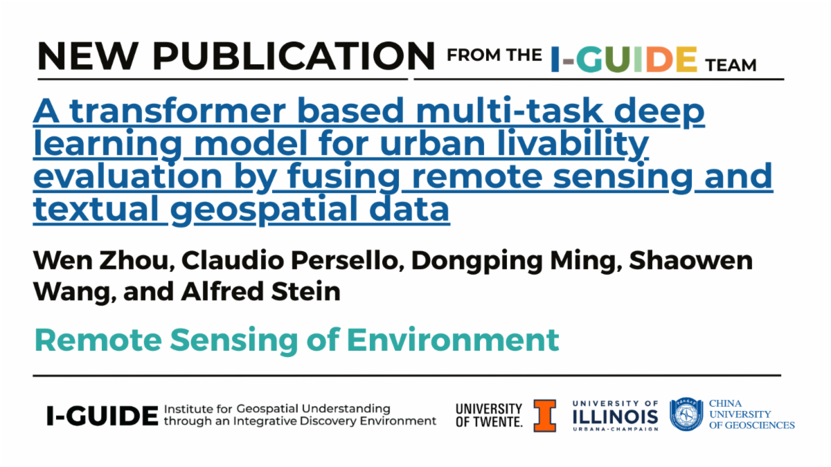
To improve the processes for evaluating urban livability, a transformer-based multi-task multimodal regression (TMTMR) model was produced that extracts features from high spatial resolution remote sensing (RS) images, digital surface models (DSM), night light remote sensing (NLRS) images and point of interest (POI) data. They found that modalities of urban livability can be effectively evaluated by aligning, in a descending order, contributions from RS images, NLRS images, DSM, and POI data. The proposed TMTMR model is capable of effectively evaluating urban livability directly from multimodal geospatial data.
|
|
|
|
|