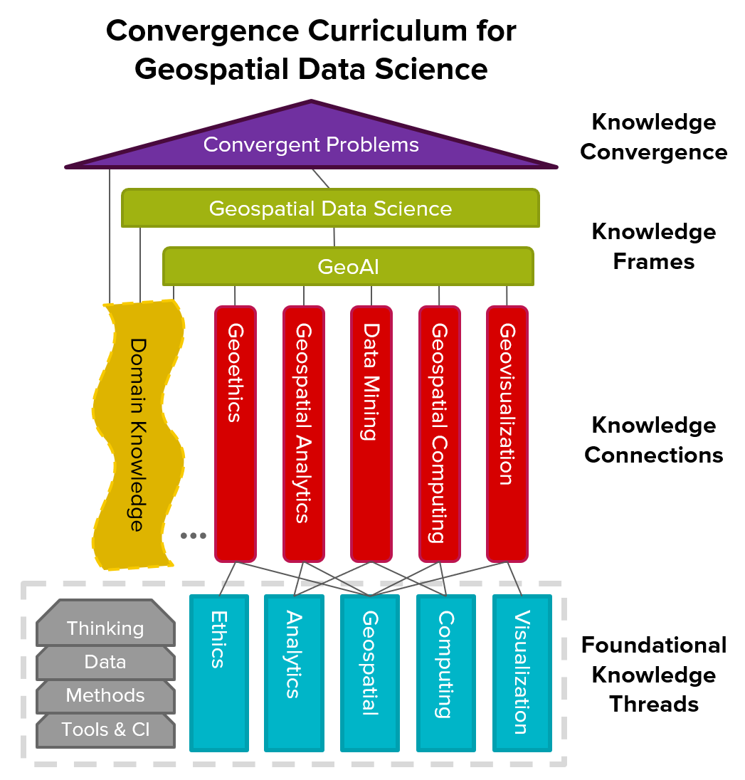
The Convergence Curriculum for Geospatial Data Science is an integrative framework designed to equip students, scholars, and professionals with the skills to address complex, real-world problems by building foundational literacy across multiple disciplines. It offers a flexible, multi-tiered structure with five Foundational Knowledge Threads, leading to Knowledge Connections and Knowledge Convergence, enabling learners to blend diverse skills, methods, and technologies. Content is available in varying depths (from brief overviews to in-depth modules), allowing for adaptable learning paths. The curriculum is continuously refined based on community feedback, with ongoing development and content releases.
1. Foundational Knowledge Thread (FKT)
2. Knowledge Connections (KC)
3. Knowledge Frames (KF)
4. Domain Knowledge (DK)
5. Knowledge Convergence
6. Community Contributions
Learn More about the NSF I-GUIDE Convergence Curriculum Program
Convergence Curriculum Powered by I-GUIDE
Eric Shook and Rajesh Kalyanam
2023 NSF I-GUIDE ForumOctober 5, 2023
Convergence Curriculum for Geospatial Data Science
Eric Shook
NSF I-GUIDE VCO SeriesFebruary 7, 2023
The Convergence Curriculum for Geospatial Data Science: Open Resources for You and your Learners
Eric Shook
NSF I-GUIDE VCO SeriesNovember 14, 2022
Navigating the Evolving Educational Landscape in a Convergent Geospatial World
Eric Shook
NSF I-GUIDE Webinar SeriesMarch 23, 2022
Presentations and Community
- I-GUIDE Webinar Series: Navigating the Evolving Educational Landscape in a Convergent Geospatial World
- UCGIS I-GUIDE Community Champions
- The Convergence Curriculum for Geospatial Data Science: Open Resources for You and Your Learners
- I-GUIDE addresses the challenge of computational reproducibility and data ethics by guiding data sharing and ethical decision-making in research practices and AI algorithms