The goal of this challenge is to develop methods for integrating and aligning vector-based hydrography data from the USGS National Hydrography Dataset (NHD) with high-resolution imagery (e.g., NAIP or similar satellite/aerial sources). By harmonizing these datasets, participants will support improved representation of surface water features in The National Map, enabling more detailed temporal analyses of water extent and conditions over time. The focus is on automating alignment and co-registration methods that ensure vector features (e.g., flowlines, waterbodies) correspond accurately with their visible counterparts in high-resolution imagery.
Study Areas
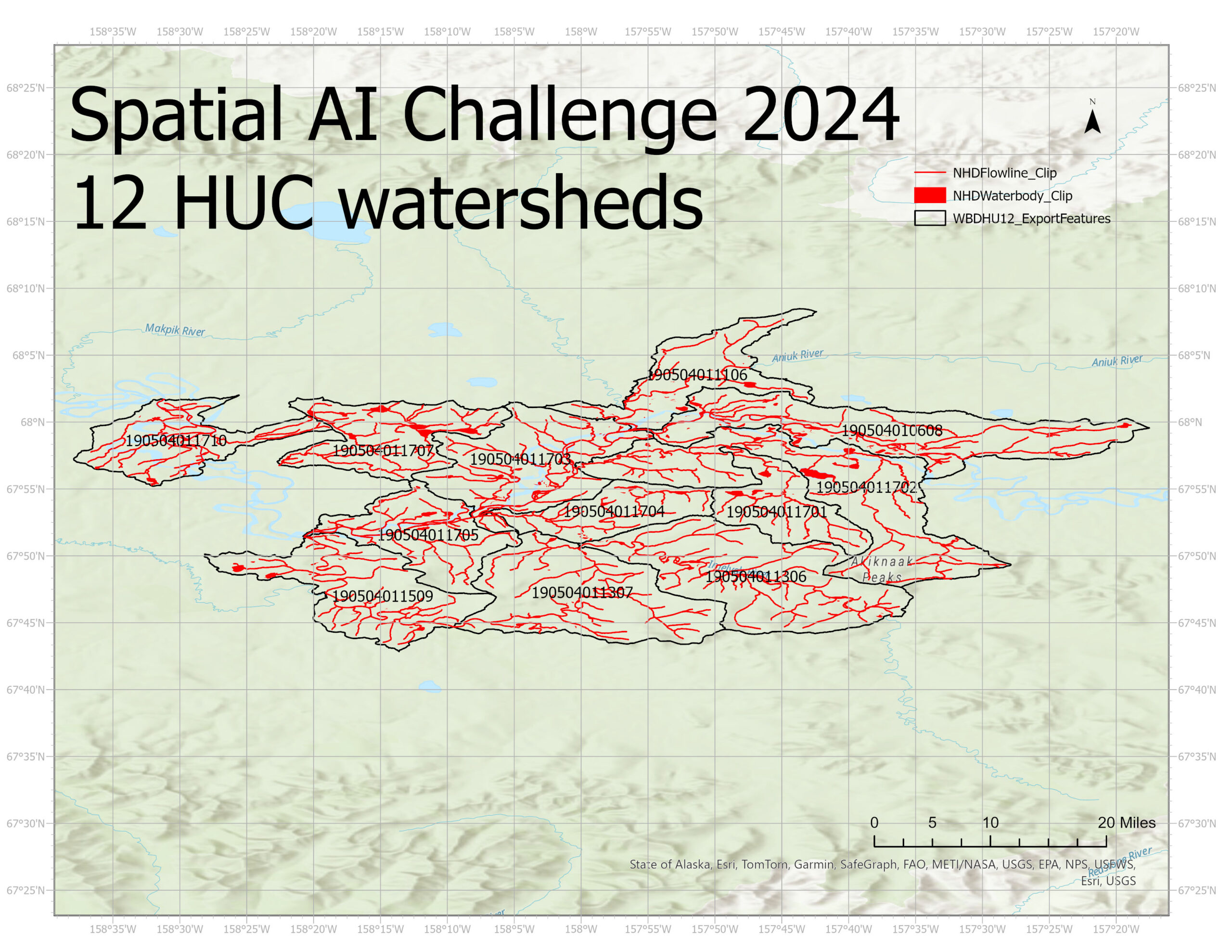
Participants will focus on a set of 12-digit Hydrologic Unit Code (HU12) watersheds in Alaska. These watersheds have been chosen for their complexity and prior availability of NHD and imagery data. Working in these specific areas ensures a common frame of reference and facilitates consistent evaluation of alignment techniques.
Selected HU12 Watersheds (HUC12 Codes):
190504010608, 190504011106, 190504011306, 190504011307, 190504011509, 190504011701,
190504011702, 190504011703, 190504011704, 190504011705, 190504011707, 190504011710
These watersheds offer a representative sample of surface water features, including streams, rivers, lakes, and wetlands, providing a robust testbed for developing and evaluating alignment methodologies.
The shapefiles for watersheds' boundaries, flowline and waterbody can be downloaded here.
Input Data
National Hydrography Dataset (NHD) (Required)
The NHD provides a comprehensive suite of hydrographic features, including vector flowlines and waterbodies, that represent a snapshot in time. These NHD features serve as baseline vector references. However, as the challenge involves improved alignment, participants will treat NHD data as input layers needing refinement rather than as a final reference.
Access: Download here
High-Resolution Satellite and Aerial Imagery (e.g., NAIP)
Participants should use high-resolution multispectral imagery—such as National Agriculture Imagery Program (NAIP) data or similarly available satellite imagery—to visually identify and delineate surface water features. These images capture water conditions more dynamically than static vector datasets. Imagery is commonly provided as georeferenced orthophotos (e.g., GeoTIFF). Participants may select suitable image bands (e.g., RGB and, if available, near-infrared) for improved water feature delineation.
Access: Acquire imagery from USGS EarthExplorer or other publicly available high-resolution sources.
Creating a Reference Dataset
A key requirement of this challenge is that participants must create their own reference water datasets. Rather than relying solely on existing vector data, participants will:
- Identify and delineate water features directly from the high-resolution imagery. This involves selecting pixels or segments that represent surface water and converting these delineations into vector or raster layers as a reference standard.
- Ensure that this derived reference layer accurately captures current conditions visible in the imagery.
These participant-created references will serve as the target for alignment. The methodology for creating these references should be transparent, reproducible, and well-documented. This includes describing the image processing techniques (e.g., thresholding spectral indices, manual digitization, or semi-automated water classification) used to identify water pixels.
Data Preparation Guidance
Participants will need to carefully harmonize coordinate reference systems and spatial resolutions:
- Coordinate Systems & Projections:
- Ensure all vector and imagery layers share a common coordinate reference and grid systems.
- Consider reprojecting and/or resampling data before alignment.
- Image Pre-processing:
- Perform radiometric corrections, normalization, or filtering as needed to enhance water detection.
- Vector Pre-processing:
- Clip or filter NHD data to match imagery extents. Consider simplifying or segmenting complex polygon edges for improved alignment algorithms.
Additional Data Sources (Optional)
Participants are allowed to incorporate other publicly available datasets if such data will enhance the alignment process. For example, using elevation data (e.g., from USGS IfSAR DEM/DSM) can provide additional context about terrain and drainage patterns. Other open datasets (e.g., global surface water maps) may also inform or validate the alignment. Any additional data sources should be:
- Publicly and freely available.
- Properly documented, including URLs, acquisition steps, and pre-processing methods.
- Integrated in a reproducible manner so that the entire workflow can be evaluated and understood.
Assessment and Evaluation Guidelines
Data Integration and Alignment
The core of the challenge involves integrating the NHD vector data with the participant-generated reference water features derived from imagery. Participants should:
- Investigate image-to-vector alignment methods, ensuring the vector flowlines and waterbody polygons correspond correctly to visible water features in the imagery.
- Explore approaches such as image transformations, reprojections, rubber-sheeting, or geometric adjustments to refine vector alignments.
- Apply automated techniques, potentially incorporating machine learning or spatial optimization algorithms, to improve alignment and reduce manual editing requirements.
Methodology Documentation
A primary evaluation criterion is the reproducibility and transparency of the approach. Participants should clearly document:
- Steps taken to obtain the raw data (imagery, NHD vectors, and any additional datasets).
- Methods and software used for pre-processing (e.g., projection changes, raster calculations).
- Procedures for creating the water reference dataset from high-resolution imagery.
- Alignment algorithms, models, or workflows employed and their parameter choices.
Performance and Error Assessment
Participants should evaluate and report:
- The quality of alignment between NHD vectors and the newly created water reference layers from the image data.
- Quantitative metrics for error and accuracy, such as positional errors, overlap ratios, or standard spatial statistics (e.g., root mean square error between vector and reference shoreline positions).
- Sensitivity analyses that consider how variations in input data, methods, or parameters affect the final alignment performance.