Our I-GUIDE Ascender this quarter is Nattapon (Nathan) Jaroenchai, a Ph.D. candidate in the Department of Geography and Geographic Information Science at University of Illinois Urbana–Champaign (UIUC) who recently successfully defended his dissertation. Nathan’s research focuses on using multimodal deep learning to extract high-resolution stream networks from satellite data, addressing longstanding gaps in traditional elevation-based mapping. His collaboration with the United States Geological Survey (USGS) aims to improve the accuracy and timeliness of national hydrography, which supports flood forecasting, ecosystem management, infrastructure planning, and climate resilience. This work is also deeply personal for Nathan. Growing up in Thailand, where seasonal flooding and water-resource challenges shape daily life, he saw firsthand the importance of reliable hydrologic information. His long-term goal is to adapt the knowledge and tools he develops in the United States to strengthen water resilience and geospatial capacity in Thailand.
As a member of the development team for the I-GUIDE website and platform, he helps create user-centered designs, improve platform usability, and support backend features that make geospatial resources easier for researchers and educators to access.
What is your current position and institutional affiliation(s)?
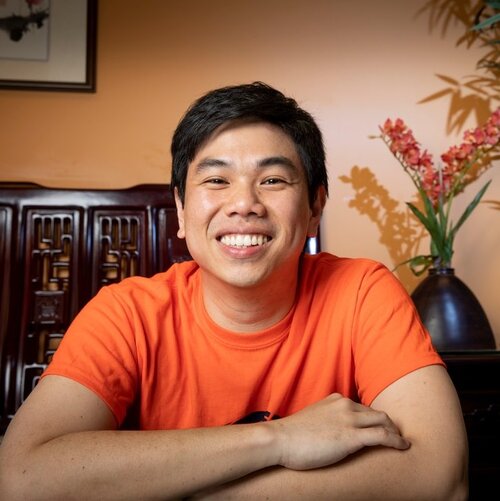
Nattapon (Nathan) Jaroenchai, a Ph.D. candidate in the Department of Geography and Geographic Information Science at UIUC
I am a Ph.D. Candidate in the Department of Geography and Geographic Information Science at UIUC. I work with the CyberGIS Center and the I-GUIDE, focusing on geospatial AI, deep learning, and large-scale hydrographic mapping.
What is your role in I-GUIDE?
I serve on the development team for both the I-GUIDE website (https://i-guide.io) and the I-GUIDE Platform (https://platform.i-guide.io). My work centers on designing intuitive user experiences and developing features that help researchers navigate complex geospatial workflows. I also support backend tools and site administration, ensuring the platform is accessible, responsive, and aligned with the needs of the broader community.
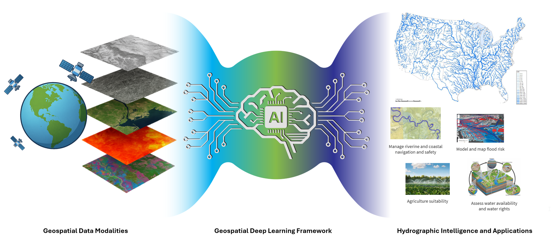
On the research side, I collaborate with the USGS to advance deep learning approaches for high-resolution hydrographic mapping. Traditional hydrography extraction methods depend heavily on elevation models, yet real-world water systems are far more dynamic. Our work brings together multiple data sources, including elevation, Synthetic Aperture Radar (SAR), optical imagery, and thermal information, to detect water channels that are often missing or misrepresented in national datasets. This effort supports flood modeling, ecosystem monitoring, infrastructure planning, and climate resilience. Many existing datasets take years to update or struggle in challenging landscapes, so developing AI-driven solutions that can scale nationally is an essential step toward more reliable and timely hydrography.
Did you start your academic career with the same goals and direction as you have now? If not, tell us a little about how and why your direction has changed?
Not at all. I did not begin my academic journey expecting to work in geospatial AI or hydrographic mapping. When I first entered geography, it was because I enjoyed maps, landscapes, and understanding how places connect. At that time, I did not yet realize how much computation and AI would transform the field.
Everything changed when I was introduced to CyberGIS. I discovered that geography could be both scientific and computational, and that high-performance computing, machine learning, and large-scale geospatial data could be combined to solve real-world challenges. This realization broadened my perspective. Geography was no longer only about making maps. It became a way to build intelligent systems capable of understanding Earth in ways people cannot achieve alone.
As I learned more, I became especially interested in water. Hydrologic features are fundamental to ecosystems and communities, yet they are incredibly difficult to map accurately at large scales. Missing or outdated hydrography affects flood prediction, environmental management, and climate resilience. This challenge motivated me to explore how AI can help create more accurate, up-to-date, and equitable hydrologic information. The work felt personally meaningful because of my experiences growing up in Thailand, where flooding and water management issues directly affect people’s daily lives.
Over time, this curiosity became a clear mission. Today, I am committed to developing scalable, AI-driven, and reproducible solutions for hydrology. My goal is to advance geospatial AI in ways that support both scientific discovery and societal benefit, and to help ensure that countries like the United States and Thailand have the tools they need for better water management and long-term resilience.
What inspires you and motivates you to do the work that you do?
I am inspired by the idea that geospatial science can directly benefit society, particularly in areas related to water, sustainability, and climate resilience. Hydrography might appear technical, but it shapes everything from flood forecasting and habitat conservation to infrastructure planning and agricultural decision-making. Knowing that my work can support more informed environmental decisions gives me a strong sense of purpose.
I am also motivated by the scientific challenges in this field. Working with massive datasets, modeling diverse landscapes, and addressing gaps in traditional mapping approaches encourages me to think creatively and carefully. I enjoy turning raw data into practical tools that help researchers, agencies, and students better understand surface processes. Designing AI systems that can operate at real-world scale is both demanding and rewarding, and the difficulty of the work pushes me to keep improving.
My background also motivates me. Growing up in Thailand showed me how deeply water influences daily life. Seasonal flooding, agricultural needs, and rapid environmental changes affect communities in visible and sometimes devastating ways. These experiences remind me that geospatial AI is not just a technical pursuit. It can help people live safer and more resilient lives. I hope the tools and knowledge I develop will one day help Thailand manage water more effectively and strengthen its resilience to climate impacts.
The I-GUIDE community inspires me as well. Being surrounded by researchers from geography, computer science, hydrology, and data science encourages constant learning and collaboration. I-GUIDE’s commitment to using cyberinfrastructure and data science to address major environmental challenges aligns closely with my own ambitions, and being part of such a forward-thinking community keeps me motivated.
Do/did you have a Plan B? What do you think you’d be doing if you hadn’t chosen an academic career?
Yes, I have always had a Plan B. If I had not chosen an academic path, I imagine I would be working as a geospatial AI engineer or data scientist in industry. I have always enjoyed building systems, designing accessible tools, and working with large datasets. A career focused on mapping, environmental analytics, or location-based technologies would have been a natural fit.
Another version of my Plan B is closely connected to Thailand. I grew up seeing how environmental challenges shape daily life. If I were not in academia, I might have worked in a government agency, research institute, or technology-focused environmental organization in Thailand. Applying geospatial analytics and AI to real-world challenges at a local or national scale has always felt meaningful to me. Helping improve water resilience and data-driven decision making in Thailand would have been a path I would gladly pursue.
Even though I chose academia, my Plan B continues to influence the work I do. It reminds me to stay grounded and to build tools that are both innovative and usable. It also motivates me to focus on research that can eventually support communities in the United States and in Thailand. In many ways, keeping this alternative path in mind strengthens my commitment to the work I do now.
What is the next chapter (aspirational or planned) in your career?
After completing my Ph.D., I will return to Thailand as part of my government scholarship pathway and begin my career as a faculty member at Khon Kaen University (https://www.kku.ac.th/en/). This next step is very meaningful to me because it is an opportunity to bring back the knowledge, skills, and perspectives I have gained through my time at UIUC and through my work with I-GUIDE. I hope to build a research group that connects geospatial AI, environmental applications, and cyberinfrastructure, and to create a space where students can explore scientific and computational ways of understanding the world.
One of my aspirations is to introduce the kind of interdisciplinary, data-driven thinking I have experienced at I-GUIDE into Thailand’s geospatial community. I want to help develop tools and methods that support water resource management, climate resilience, and sustainable development. By adapting national-scale methodologies to Thailand’s unique landscapes and data environments, I see significant potential to improve hydrologic mapping, flood forecasting, and environmental monitoring across the country.
In the long term, I aim to contribute to Thailand’s national geospatial initiatives and help shape the next generation of spatial data scientists. I hope to mentor students who are excited about using AI and geospatial technologies to solve real-world problems and to support opportunities for Thai researchers to collaborate internationally. I also plan to continue working with the I-GUIDE community to promote open science, reproducible workflows, and global partnerships in geospatial research.
Ultimately, I hope to serve as a bridge between the innovation I have learned in the United States and the needs and potential of Thailand.
What would you like to be when you grow up?
I hope to become a researcher, educator, and innovator who helps make geospatial science more accessible, scalable, and impactful. I want to build tools, platforms, and knowledge that allow communities, agencies, and students to use spatial data more effectively in their decision-making. Whether it involves improving flood resilience, supporting environmental planning, or enabling open and reproducible geospatial workflows, I want my work to create long-lasting value.
I also hope to inspire the next generation of spatial thinkers, especially in Thailand. I want students back home to see that geospatial AI is not only technical but also creative and meaningful. Through teaching, mentorship, and collaboration, I hope to help young researchers explore bold ideas and develop confidence in their ability to contribute to global scientific challenges.
On a personal level, when I grow up, I want to be someone who never stops learning. I want to stay curious, open-minded, and excited about new possibilities. Most of all, I want to keep finding joy in helping others discover the power of geospatial thinking, whether through research, education, or by sharing my passion with the communities I serve.