|
Replacing the natural in disaster with the right data to inform decisions
|
|
|
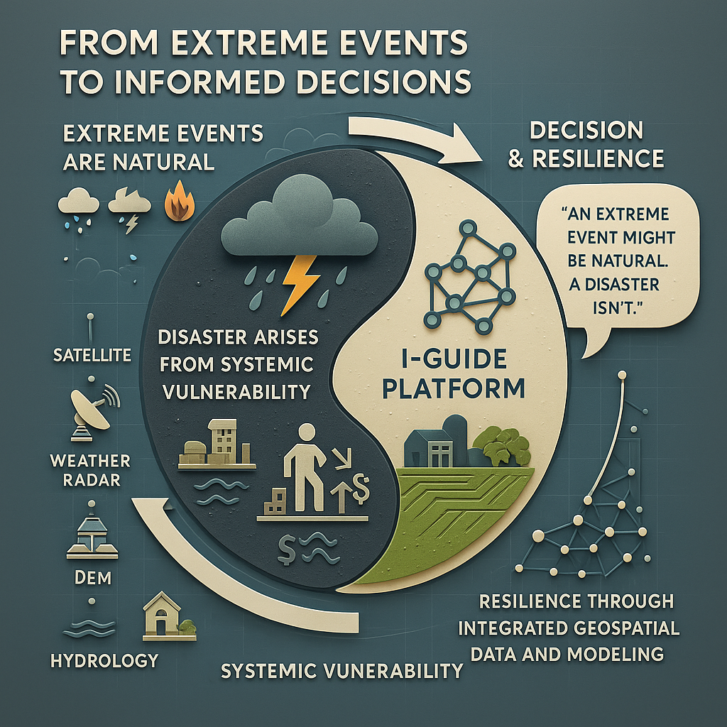
In a world that floods, shakes, snaps to the winds, cracks in drought and burns, it’s easy to assign an event to a single place, a specific time. But reality serves a challenge to look beyond what’s labeled a disaster.
The interdisciplinary teams of scientists in I-GUIDE, the Institute for Geospatial Understanding through an Integrative Discovery Environment, works on turning that journey into holistic understandings and solutions.
“The term natural disaster is an absolute misnomer,” said Courtney Flint, a Utah State University professor of environment and society. “An extreme event might be natural. A disaster isn’t natural – it has social, economic and technical components that make it not natural.”
|
|
|
The upcoming 2025 I-GUIDE Forum, Geospatial AI and Innovation for Sustainability Solutions, features presentations, panels, and posters that collectively highlight the top activities in GeoAI, cyberinfrastructure, and geospatial sciences today! Our co-location with the Sustainability Research & Innovation Congress (https://sricongress.org) allows participants in the I-GUIDE Forum to take advantage of the momentum, energy, and synergies of several thousand people gathering to work on solutions to our most significant sustainability challenges. One single registration is full access for both events! Plus, all workshops and tutorials are FREE for any registrants!
Register today for the Forum and the Workshops, and plan your travel to join us (with discounted prices) at the Sheraton Grand Chicago Riverwalk hotel, June 17 - 19, 2025.
|
|
|
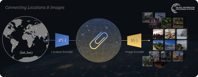
Six teams recently completed our inaugural Spatial AI Challenge, leveraging the I-GUIDE Platform to develop innovative, responsible, and reproducible solutions using FAIR data and open science. This year's winning team - from Purdue University's Rosen Center for Advanced Computing - extended and fine-tuned GeoMapCLIP to rapidly and readily localize unknown geospatial images using visual cues. Explore all of the completed and winning projects and watch for an announcement of another Challenge!
|
|
|
The 2025 Summer School - with a focus on Spatial AI for Extreme Events and Disaster Resilience - will take place August 4-8, 2025 at the University Corporation for Atmospheric Research (UCAR) Center Green campus in Boulder, Colorado. Almost 100 people applied for 25 participant slots, and our cohort will be exceptional in many ways! Descriptions of the five team-based projects will be shared in June.
|
|
Stay Informed with the I-GUIDE Insider
An easy way to stay in touch with the NSF I-GUIDE Project
|
|
|
The I-GUIDE Insider is a weekly digest of upcoming events and opportunities from the I-GUIDE project as well as recent publications and news. Sign up for the Insider to stay up to date with the I-GUIDE project!
|
|
I-GUIDE VCO
Wednesday, May 21 · 11:00am CT · Virtual
Presenter
Fangzheng Lyu · Virginia Tech University
This session presents a convergence framework on the I-GUIDE Platform that integrates cyberGIS education and research using FAIR data principles. It enables scalable, reproducible geospatial analytics via interactive Jupyter Notebooks. A case study with Twitter data illustrates its application through six research and four education notebooks
|
|
I-GUIDE VCO
Wednesday, May 28 · 11:00am CT · Virtual
Presenter
Alex Michels · University of Illinois Urbana-Champaign
Spatial accessibility is a valuable tool for analyzing mismatches between supply and demand across space. We will begin with a brief overview of spatial accessibility followed by a hands-on demo using the Python Pysal access package to calculate spatial accessibility. This talk is open to Python users of all skill levels.
|
|
I-GUIDE VCO
Wednesday, June 4 · 11:00am CT · Virtual
Presenter
Caylee Chan · University of Illinois Urbana-Champaign
Learn how green stormwater infrastructure (GSI), such as infiltration catch basins and rain gardens in Aurora, Illinois, reduces mosquito habitats linked to West Nile Virus. Using site suitability modeling, researchers aim to identify optimal GSI locations and assess potential public health benefits through reduced mosquito-borne disease risk.
|
|
I-GUIDE VCO
Wednesday, June 11 · 11:00am CT · Virtual
Presenter
Wen Zhou · University of Illinois Urbana-Champaign
This study introduces a transformer-based multi-task multimodal regression (TMTMR) model to evaluate urban livability across five domains. Using remote sensing, POI data, and pretrained AI models, it automates livability assessments, reducing reliance on labor-intensive data collection. Attention mechanisms enhance feature significance across data types, improving evaluation accuracy.
|
|
|
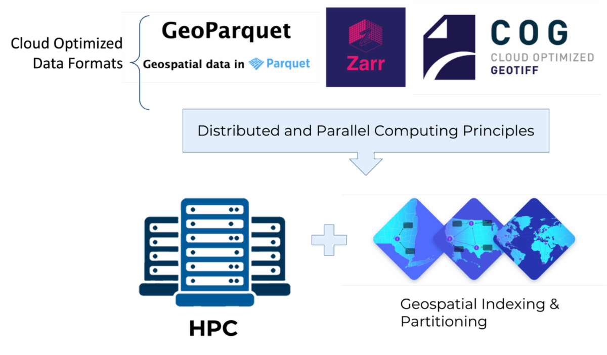
Parallelization is critical in processing, particularly in High-Performance Computing (HPC). Current formats are mainly designed for single processing units like personal computers. However, cloud-optimized formats offer partial access and parallelization capabilities. This led to a key research question for the OGC Testbed 20 HPGC optimized formats initiative that I-GUIDE, OGC, and others are pursuing together: Could existing cloud-optimized formats be effectively utilized as HPC-optimized formats? Additionally, what were the optimal solutions for developing an HPC-optimized format? The approach, shown below, has involved testing three different cloud-optimized formats in HPC environments and evaluating whether the existing tooling and open libraries could be easily utilized in this context.
|
|
|
How will this help researchers and geospatial practitioners with their computing needs? As one example, I-GUIDE has been developing algorithms that aid in assessing social vulnerability associated with aging dam infrastructure. Within the Testbed 20 initiative, the aging dams algorithm - originally executed within the CyberGIS-Compute environment - was almost entirely replicated utilising open-standard APIs. Other infrastructure components associated with processing were duplicated in Testbed 20 by substituting the existing infrastructure to demonstrate an alternative method based on open standards and platforms. This demonstrates the versatility of I-GUIDE’s Platform to support open science and the potential for standards-based HPC to be used more widely elsewhere. The Testbed 20 HPC Initiative report has been published and can be found here.
|
|
|
The latest cutting-edge research and publications
from the NSF I-GUIDE Project Team
|
|
|
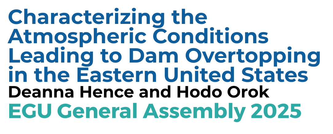
This study analyzes atmospheric conditions linked to dam incidents in the eastern U.S., identifying compound tropical cyclone and frontal events as major risks. Catchment-level data reveal prior frequent rainfall contributes to failures. Regional analysis aims to improve prediction of dam risks amid intensifying precipitation under future climate scenarios.
|
|
|
|
|