Author: Sue Nichols, Michigan State University
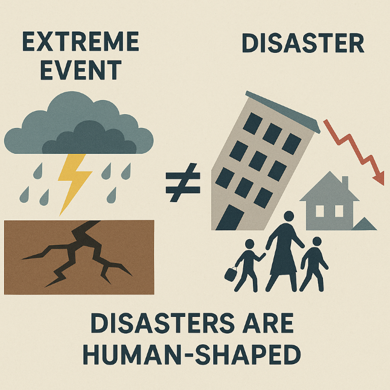
An extreme event might be natural. A disaster isn’t natural – it has social, economic and technical components that make it not natural.
In a world that floods, shakes, snaps to the winds, cracks in drought and burns, it’s easy to assign an event to a single place, a specific time. But reality serves a challenge to look beyond what’s labeled a disaster.
The interdisciplinary teams of scientists in I-GUIDE, the Institute for Geospatial Understanding through an Integrative Discovery Environment, works on turning that journey into holistic understandings and solutions.
“The term natural disaster is an absolute misnomer,” said Courtney Flint, a Utah State University professor of environment and society. “An extreme event might be natural. A disaster isn’t natural – it has social, economic and technical components that make it not natural.”
The researchers who work on the convergence science of I-GUIDE are looking to harness the power of enormous geospatial data sets to understand, predict and help build resilience to some of the sweeping challenges in today’s world. Their work is supported by the National Science Foundation.
And that’s where the differences between an extreme event and a natural disaster become crucial. If we define as a natural disaster every time nature swings towards the extreme, it misses the cascade of effects and responses that can throw humans into suffering and disarray. Such as when a drought brings food shortages, leading to famine and ultimately displacement of its victims.
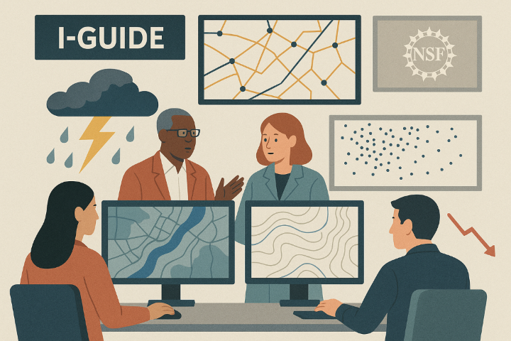
Collaboration and data analysis are essential tools in preparing for and mitigating the impact of disasters
Rather, I-GUIDE is seeking to understand and model potential failures in systems to find ways to prepare.
I-GUIDE scientists, for example, are working on understanding the vast network of aging dams in the United States that are in many cases in danger of failing. This isn’t merely a question of engineering, or hydrology, or geography. It is measuring the potential for many systems that cause natural hazard events to trigger technological emergencies.
Putting all these pieces into play is a complex issue that requires balancing many types of data to understand how the rivers and lakes being managed may be affected by heavy rains, under what conditions dams may no longer contain those bodies of water and a complex chain of events predicting what would happen if those dams failed.
But it’s also important not to label intense rain events as disasters.
“Dams don’t fail every time it rains a lot,” Flint said. “But the increase in extreme precipitation events affects the risk calculus related to aging dams. Our job is to integrate an understanding of compounding risks, along with the vulnerabilities associated with each dam we investigate, to highlight the potential disasters we need to work to avoid.
“In other words, we aren’t studying disasters as much as we are studying ways to understand risks in order to hopefully avoid them.”
And those challenges need approaches that draw from large, diverse teams capable of making sense of huge amounts of data. The nature of disasters is complicated – a cascading failure of not only infrastructure or the stability of the ground beneath, but also miscalculations of human behavior, economics, policy or preparation.
The Concept of Telecoupling
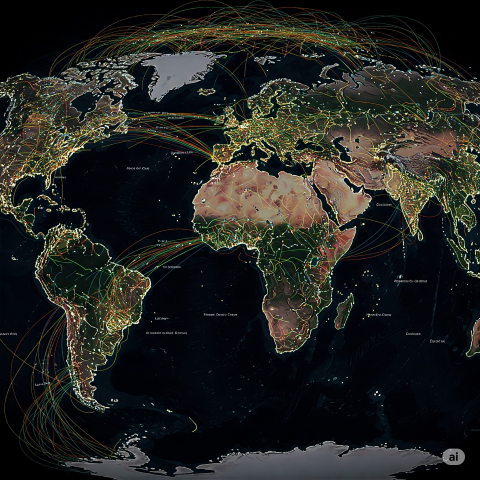
Telecoupling emphasizes the interconnectedness of our world, illustrating how disasters in one location can have far-reaching effects.
In our interconnected world, disaster effects involve communities and ecosystems far away from one another, meaning they are “telecoupled.” A dam failure, for instance, can lead to cascading effects by moving massive amounts of water very quickly. These effects can include the destruction of aquatic habitats, the movement of chemicals and sewage in floodwaters, or even the downstream failure of another dam.
Damage along the flood path to transportation infrastructure, such as roads or bridges, to power plants, which produce power for surrounding areas, or to factories, which could produce goods traded around the world, are other ways that telecoupled cascading effects branch out much further than the original location of the collapsed dam.
I-GUIDE research employs the concept of telecoupling to extend considerations further than where an extreme event occurred.
Understanding Social Cascades
Susan Cutter, a Carolina Distinguished Professor of Geography at the University of South Carolina where she directs the Hazards Vulnerability and Resilience Institute, serves on I-GUIDE’s external advisory board. As part of gaining a better perspective of the extent of effects of extreme events, she introduced the concept of social cascades – the domino effect of people being struck by a second or third disaster.
“People see an initial event as discrete, but by the second or third event the initial disaster no longer is understood as singularity but becomes intertwined in its effects and historical meaning with other events,” she wrote in a 2018 article in Environment. “The concept of social cascades does not prioritize disasters by arguing that one was more damaging than the other; rather, it seeks to understand the complexity of how disasters that happen in quick succession have a perverse multiplier effect (tipping point) on the spatial and temporal extent and nature of social existence, historical memory, damage sustained, and efforts to realize recovery.”
Actionable Information for Decision-Makers
One of the challenges in responding to both extreme events as well as disasters is to have knowledge available more readily and rapidly.
“Ultimately, we need to have actionable information available to decision-makers and first responders,” said I-GUIDE co-leader Diana Sinton, a senior research scientist at the University Consortium for Geographic Information Science. “It’s complicated, and it takes significant coordination across entities. Systems like the I-GUIDE Platform, that aim to have data, models, and computing resources combined and integrated ahead of time, represent an important part of the puzzle.”
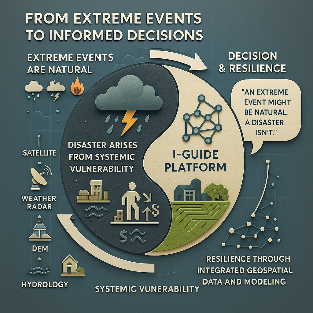
This infographic illustrates how extreme events, while natural in origin, become disasters through systemic vulnerabilities in human and environmental systems. It highlights I-GUIDE’s role in transforming raw geospatial data—such as satellite imagery, DEMs, and hydrology—into actionable insights. By integrating diverse data and advanced modeling, the I-GUIDE Platform supports informed decision-making and resilience building, moving from reactive disaster response to proactive risk management.
Image Credits: All infographic and illustration visuals in this article were generated using AI tools (OpenAI’s DALL·E and Google’s Gemini) based on descriptions provided by the author. Images are intended for conceptual and educational purposes.